
The Indochinese Peninsula Will Experience Wind and Rainfall from the 6th to the 9th by Typhoon "KALMAEGI"
Typhoon No. 25 "KALMAEGI", made landfall near the coast of Leyte Island in the Philippines around 00:00 on November 4 (Beijing time, same below). Affected by the typhoon, heavy rainfall occurred across most of the Philippines from November 2 to 5, with cumulative precipitation ranging from 30 to 80 mm. Some areas recorded 100 to 180 mm, and localized regions exceeded 200 mm, with the maximum reaching 285 mm (Figure 1). The intense rain triggered widespread flooding, resulting in significant casualties and substantial property damage.
At 10:00 on the 6th, the center of Typhoon "KALMAEGI" (Super Typhoon category) was located approximately 295 kilometers southeast of Quy Nhon City, Gia Lai Province, Vietnam, over the southwestern waters of the South China Sea. It is expected to move west-northwestward at a speed of 20-25 kilometers per hour. The typhoon's intensity will be maintained during the daytime today and will start to gradually weaken in the evening. It is forecasted to make landfall along the central coast of Vietnam tonight, with wind speeds of 40-45 meters per second (equivalent to 13-14 on the Beaufort scale, classified as a typhoon or severe typhoon). After landfall, its intensity will rapidly diminish (Figure 2).
It is forecasted that from the 6th to the 9th, Typhoon "KALMAEGI" and its remnants will impact the central and eastern regions of the Indochinese Peninsula. During this period, moderate to heavy rain is expected in Vietnam, the Malay Peninsula, southern Laos, central and northern Cambodia, central and northern Thailand, and southeastern Myanmar. Some areas will experience torrential rain or severe downpours, with coastal regions also facing strong winds (6-8 Beaufort scale, gusts of 9-10 Beaufort scale) (Figure 3). The cumulative precipitation in most of these areas is expected to reach 30-60 mm, with some regions receiving 80-120 mm, and localized areas exceeding 180 mm (specifically at the border between Kon Tum and Gia Lai Provinces in Vietnam) (Figure 4). Attention should be given to the adverse effects of the strong winds and rain on power facilities, transportation, and other industries, as well as the potential for localized heavy rainfall to trigger secondary disasters such as flooding, landslides, mudslides, and urban waterlogging.
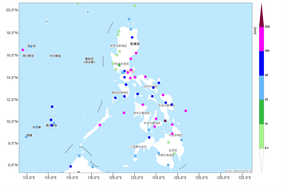
Figure 1 Accumulated Precipitation in the Philippines from November 2 to 5 at 08:00 (Unit: mm)
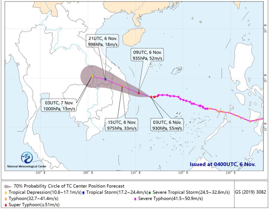
Figure 2 36 Hour Probabilistic Track Forecast for Typhoon "KALMAEGI"
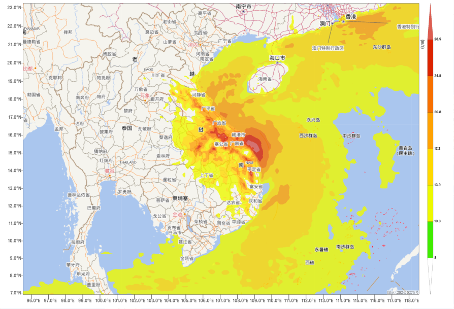
Figure 3 Maximum Gust Wind Speeds at 08:00 on November 7th (Unit: m/s)
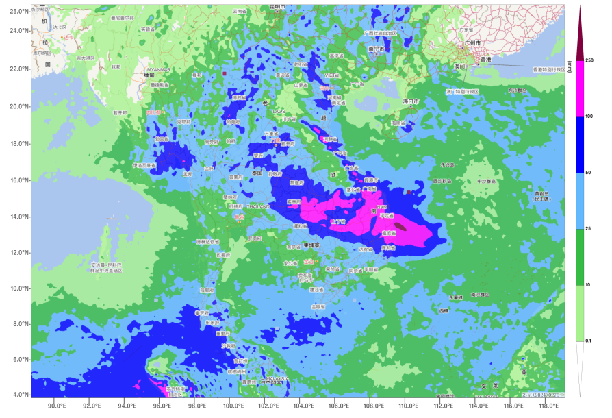
Figure 4 Forecasted Accumulated Precipitation from 08:00 on November 6 to 08:00 on November 10 (Unit: mm)
![]()
Author: Min Ying, Lv Xinyan Reviewer: Zhang Bo
English reviewer:Wang Yi Issue approver:Dai Kan