
Starting from December 2nd, Typhoon "KOTO" will impact the Indochina Peninsula
Typhoon "KOTO", the 27th of this year, was located at 09:00 AM (Beijing time) today (the 29th) approximately 360 kilometers south of Sansha City, Hainan Province (Xisha Yongxing Island), in the southwestern part of the South China Sea. The center was at 13.6°N and 112.3°E, with maximum winds near the center reaching 10 levels (28 m/s) and the minimum central pressure at 982 hPa. It is expected that "KOTO" will meander with little movement over the southwestern South China Sea, gradually weakening in intensity (Figure 1).
Affected by Typhoon "KOTO" from December 2 to 5, strong winds and heavy rain are expected in the eastern and southern regions of the Indochinese Peninsula. Specifically, parts of the central and the southern Vietnam, southern Laos, and Cambodia will experience moderate to heavy rain, with localized areas facing torrential or extreme downpours. These areas will also be accompanied by strong winds of 4 to 5 on the Beaufort scale, with gusts exceeding 7 levels (Figure 2). Accumulated precipitation in most of these areas will range from 30 to 50 mm, with some regions receiving 70 to 100 mm, and locally exceeding 200 mm (Figure 3). The intense rain and wind are likely to disrupt power facilities, transportation, and cause the collapse of buildings. There is a high risk of secondary disasters such as flooding, landslides, and mudslides, necessitating advance precautions.
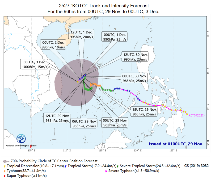
Figure 1 120-hour Probabilistic Track Forecast for Typhoon "KOTO"
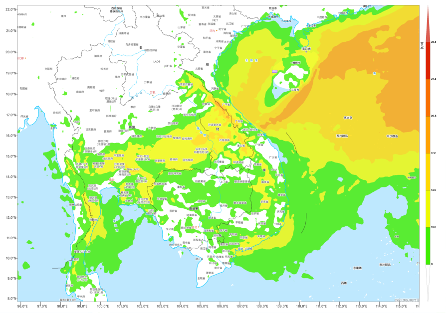
Figure 2 Maximum Gust Wind Speed (in m/s) for a 6-Hour at 20:00 (Beijing Time) on December 4
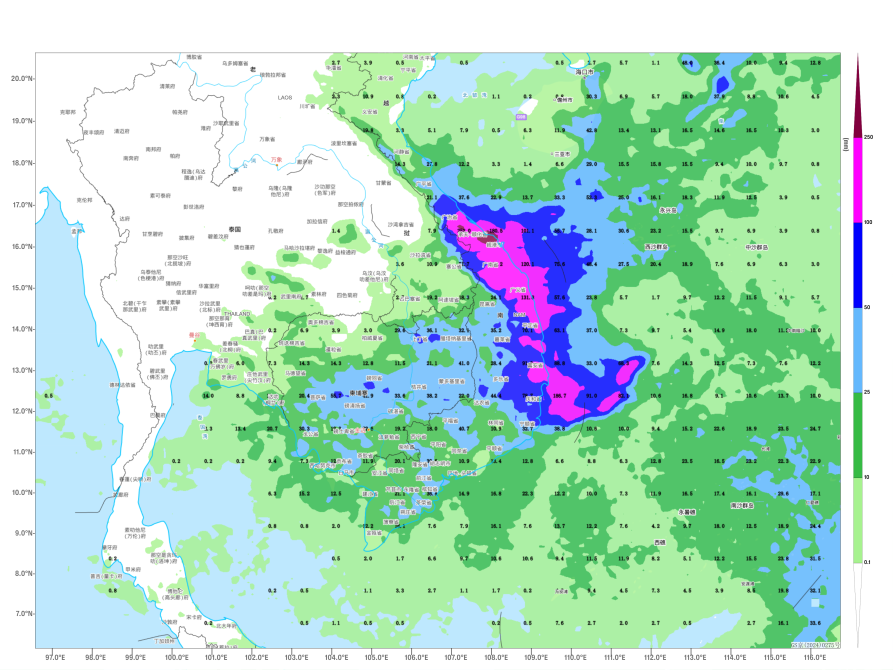
Figure 3: Forecasted Accumulated Precipitation from 08:00 on December 2 to 08:00 on December 5 (Beijing Time) (Unit: mm)
![]()
Author: Xu Xianhuang, Lv Xinyan Reviewer: Zhang Bo
English reviewer:Wang Yi Issue approver:Dai Kan