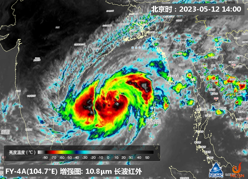
"Mocha" in the Bay of Bengal was lying 860 km S-SW of Sittwe, Myanmar at 06 UTC 12 May (Fig.1). The maximum sustained wind near the TC center was 35 m/s, and the minimum sea level pressure was 970 hPa.
The Infrared enhanced cloud image of FY-4A (Fig. 2) meteorological satellite at 06:00 shown the cloud top brightness temperature of the circulation center is below -80℃.
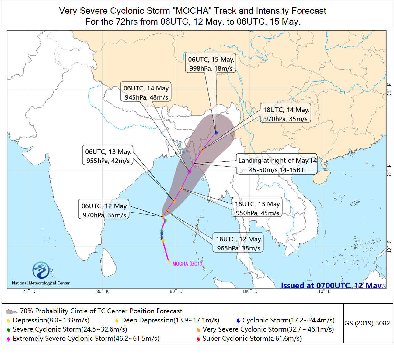
"Mocha" is forecasted to moving north-northeastward at a speed of 10 kilometers per hour. And it is intensifying to an extremely severe cyclonic storm as it approaching the coast of Myanmar and Bangladesh. The anticipated landfall is on the coast near the border between Myanmar and Bangladesh at night of 14 May. The expected landfall intensity is approximately 45~50 m/s (Fig.3). After landfall it will weaken and dissipate in land.
Affected by “Mocha”, severe wind and rain which may cause damage or injury will occur near the borders among Myanmar, India, and Bangladesh from May 14 to 16. The maximum accumulated precipitation of the above mentioned area will be more than 300 mm, and the 24h rainfall in the southern part of Bangladesh and western part of Myanmar may be more than 100 mm. Meanwhile, winds with speed between 20m/s to 26m/s and gusts spread from 28m/s to 35m/s will also be possible near the border of Myanmar and Bangladesh. (Editor: Huang Yiwu, Wang Qian, Liu Da, Ma Jie, Meng Qingtao)

Fig. 1. Cloud map of FY-4A of “MOCHA”, acquired at 06:00(UTC) on May 12, 2023.

Fig. 2. Infrared enhanced imagery of FY-4A, acquired at 06:00(UTC) on May 12, 2023.

Fig.3 Track and intensity forecast of "Mocha"
 京公网安备 11040102700102号