Cyclonic Storm "DITWAH" to Impact Sri Lanka and Southeast India
Cyclonic Storm "DITWAH" was located approximately 560 kilometers south of Chennai, India, in the North Indian Ocean, at 08:00 AM (Beijing Time) today (Nov. 28th). The storm's center was at 8.1 degrees North latitude and 81.1 degrees East longitude, with maximum sustained winds near the center reaching 8 on the Beaufort scale (18 meters per second), equivalent to a tropical storm in China. The central pressure was 1004 hPa. It is expected that "DITWAH" will move northwestward at a speed of 8 kilometers per hour, with little change in intensity (Figure 1).
Affected by "DITWAH", from November 28 to December 1, strong winds and heavy rain are expected to impact Sri Lanka and the southeastern coastal regions of India. In particular, most of Sri Lanka, the eastern part of Tamil Nadu in India, and the city of Chennai will experience heavy to very heavy rainfall, with some areas likely to see extremely heavy downpours. These conditions will be accompanied by strong winds of 7-8 on the Beaufort scale, with gusts potentially exceeding 10 levels (Figure 2). Accumulated precipitation in these regions is forecasted to range from 70 to 120 millimeters, with some areas receiving 120 to 150 millimeters, and localized totals exceeding 200 millimeters (Figure 3). The severe weather is expected to disrupt power facilities, transportation, and cause structural collapses. There is a high risk of secondary disasters such as flooding, landslides, and mudslides, necessitating advance precautions.
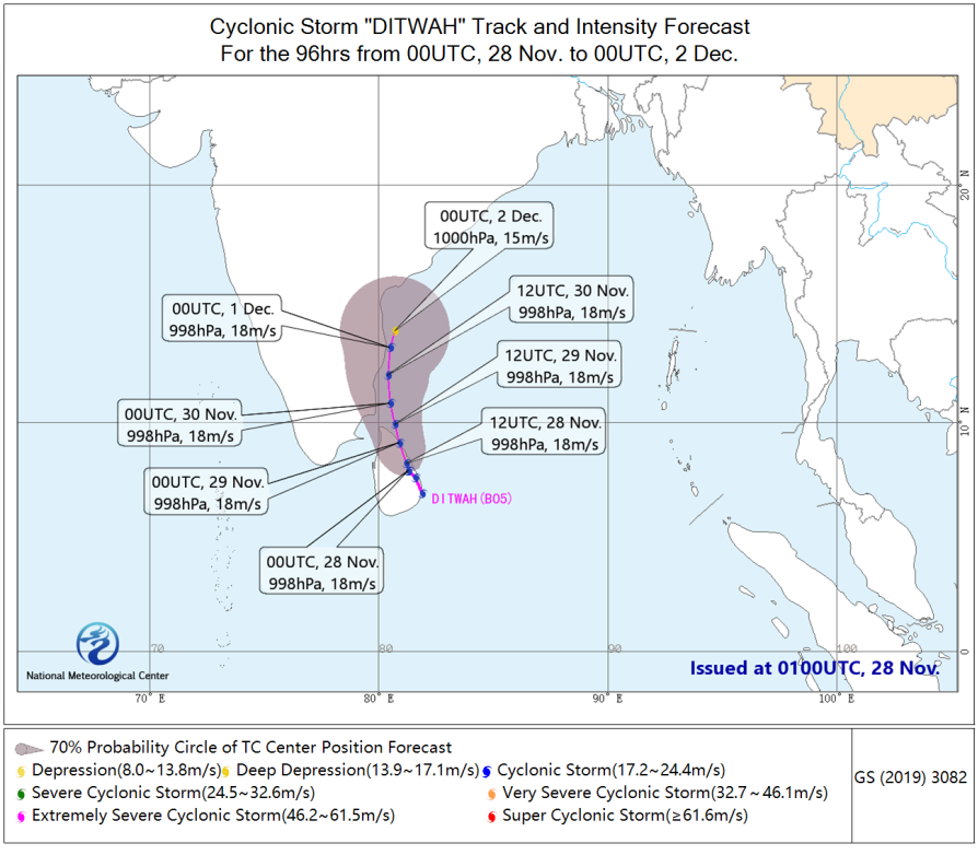
Figure 1: 96-Hour Probabilistic Track Forecast for Cyclonic Storm "DITWAH"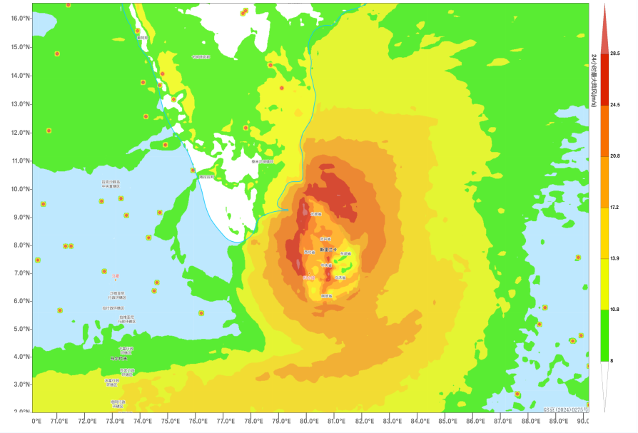
Figure 2: Maximum Gust Wind Speeds (in m/s) Over the Past 24 Hours as of 20:00 (Beijing Time) on November 29
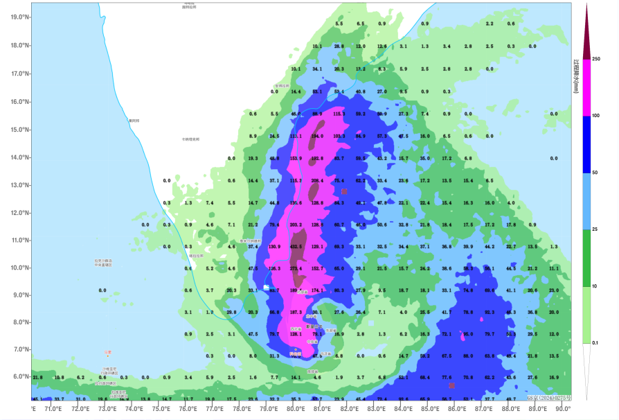
Figure 3: Forecasted Accumulated Precipitation from 20:00 on November 28 to 20:00 on December 1 (Beijing Time), in millimeters (mm)
![]()
Author: Kong Linghan, Zhang Ling Reviewer: Zhang Bo
English reviewer:Dai Kan Issue approver:Wang Yi