
Heavy Rainfall and Convective Weather in Central and Southeastern Brazil
Affected by a low-pressure trough (Figure 1), it is expected that from January 21 to 23, 2026, central and southeastern Brazil will experience moderate to heavy rainfall, with some areas facing torrential rain and localized extreme downpours. The regions most likely to be impacted include Mato Grosso, Goiás, the Federal District, Minas Gerais, Espírito Santo, and Rio de Janeiro. The cumulative rainfall during this period is anticipated to be between 50 and 90 mm with some areas receiving 120 to 180 mm and localized regions exceeding 200 mm (Figure 2). This heavy precipitation will be accompanied by severe convective weather, including short-duration intense rainfall and thunderstorms with strong winds (Figure 3). Precautions are advised against potential secondary disasters such as flooding, landslides, debris flows, and urban waterlogging in the aforementioned regions, as well as adverse impacts on power facilities, transportation, and other sectors.
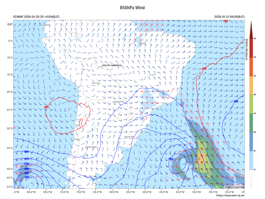
Figure 1 Forecast of 500 hPa Geopotential Height (units: dagpm) and 850 hPa Wind Field at 08:00 (BJT) on January 21, 2026 (units: m/s)
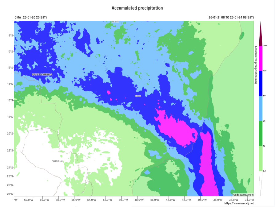
Figure 2 Accumulated Precipitation from 08:00 on January 21 to 08:00 on January 24, 2026 (BJT, units: mm)
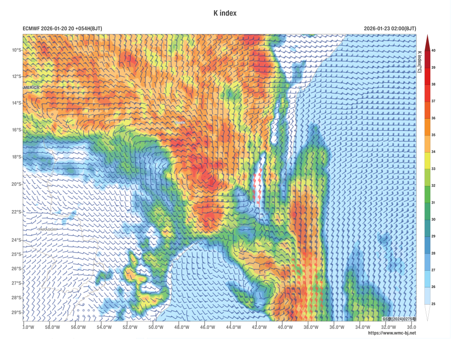
Figure 3 Forecast of 850 hPa Wind Field (wind barbs, units: m/s) and K-Index (shaded, units: °C) at 02:00 (BJT) on January 23, 2026
Author: Xie Jin Reviewer: Zhang Bo
English reviewer:Wang Yi Issue approver:Dai Kan