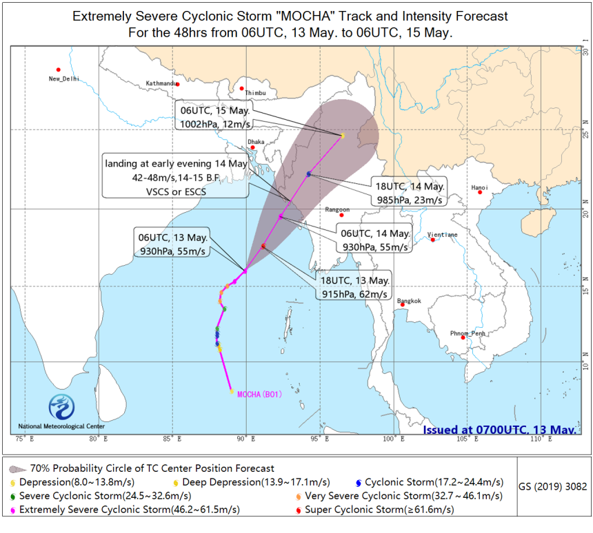
The center of the Mocha, the Extremely Severey Cyclone Storm (ESCS) in the Bay of Bengal, is located at 14:00 (Beijng time) 13th May in the middle of the Bay of Bengal, about 580 km southwest of Sittwe, Myanmar.
It is expected that "Mocha" will move to the east-north direction at a speed of about 20 km/hr with its intensity continuing to increase, and it will develop into a Super cyclone storm (Sucs) (62-65m/s, equivalent to the super typhoon level in China), and its intensity will gradually weaken during the day of14th May, and it will make landfall in the coastal area from Northwest Myanmar to Eastern Bangladesh around the evening of 14th May (grade 14-15, 42-48m/s, a very strong cyclone storm or a very strong cyclone storm, which is equivalent to a strong typhoon level in China), is likely to land in the coastal area of Rakhine State, Myanmar, and its intensity will decrease rapidly after landing.
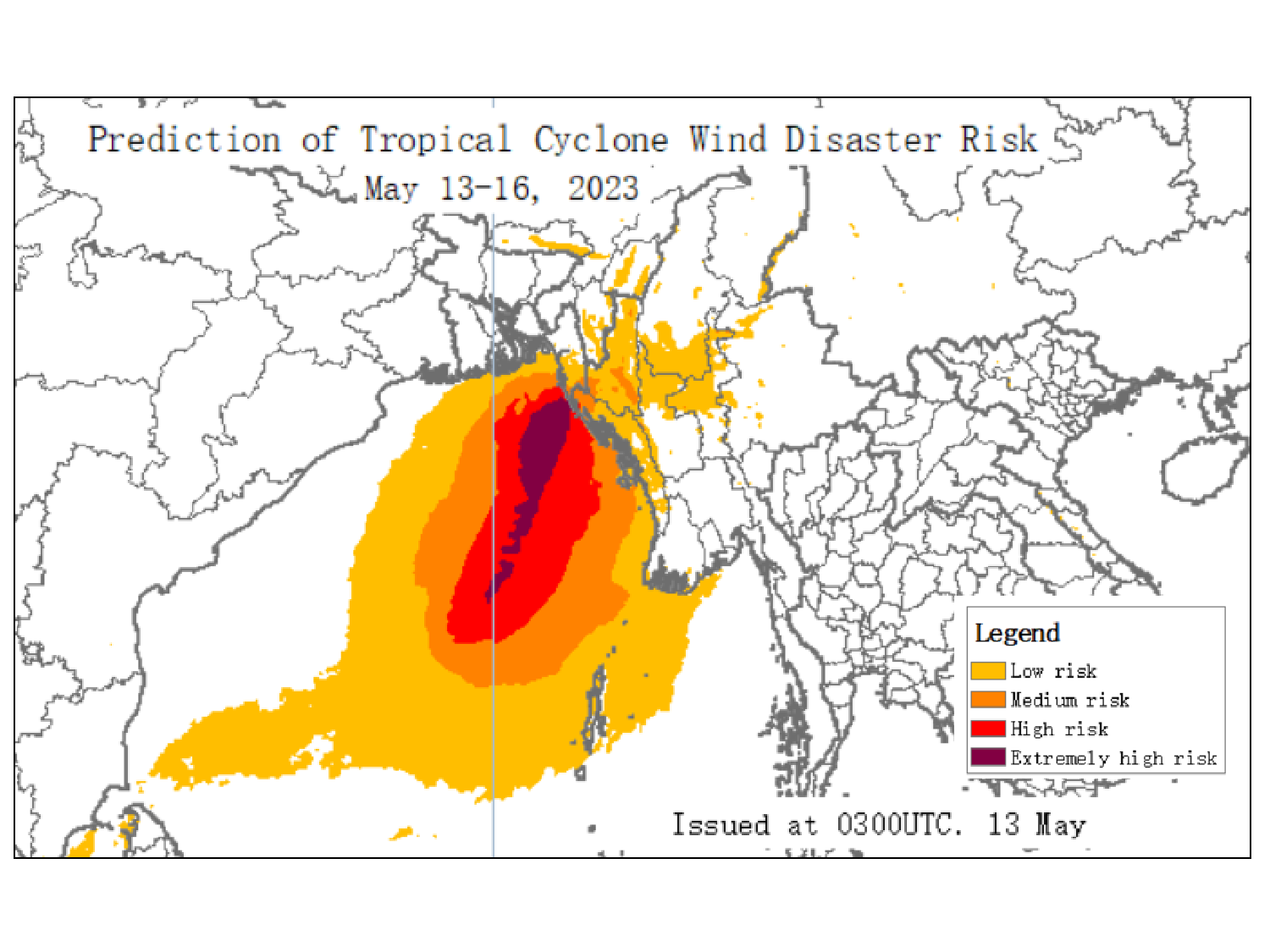
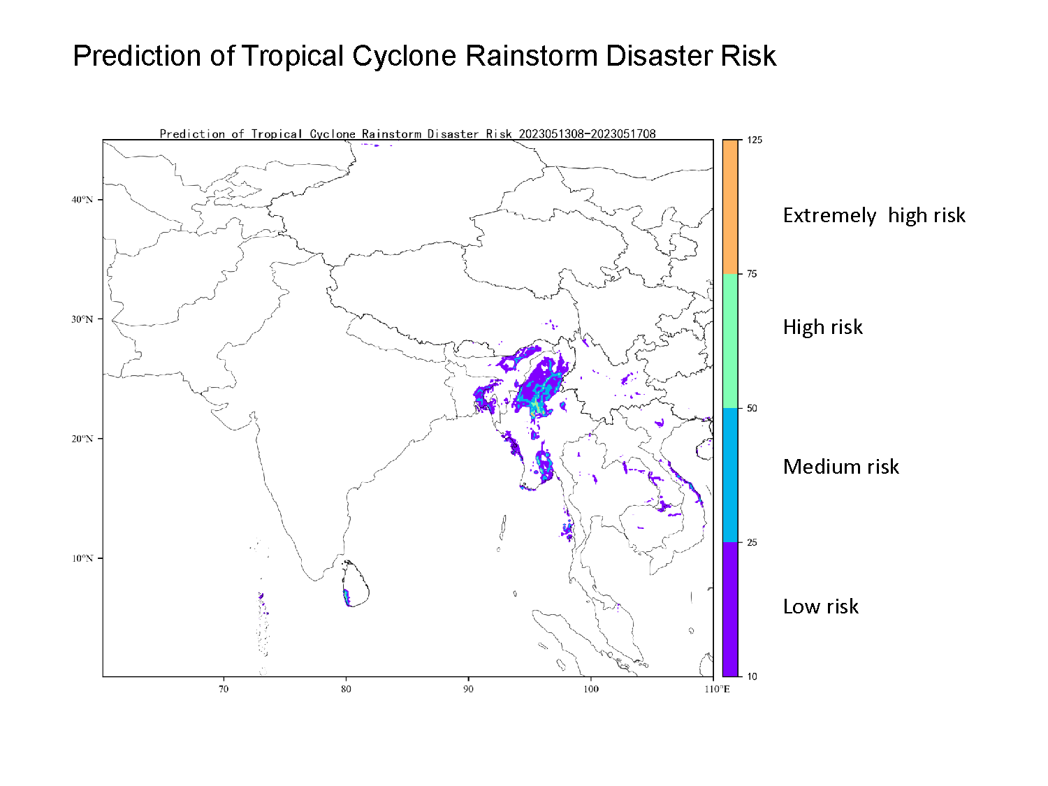
Affected by "Mocha", there will be 9-11 grade winds in the central and northeastern waters of the Bay of Bengal, the northwest coast of Myanmar and the eastern coast of Bangladesh from the evening of the 13th to the 14th, and the winds in some areas or sea areas can reach 12-14 grade. The winds in the nearby seas or areas passing by the "Mocha" Center will be 15-17 grade, with gusts above 17 grade. From 14th to 15th May, there will be heavy rain in parts of northwestern Myanmar, eastern Bangladesh and northeastern India with very heavy rain locally.
The storm surge in the North Myanmar coast during the time of landfall will reach 3-3.2 meters above normal tide levels, and astronomical tide is also high at this time.


