It is reported that the typhoon“MALAKAS” was located at 12.3°N and 136.3°E at 0:00 (UTC time, the same below), about 930 kilometers west of Guam. It had a maximum wind speed of 25 m/s and a minimum pressure of 985 hPa near the center of the typhoon.
The typhoon“MEGI” was located at 11.0°N and 124.8°E at 0:00 (UTC time, the same below), near the Philippine Islands. It had a maximum wind speed of 20 m/s and a minimum pressure of 995 hPa near the center of the typhoon.
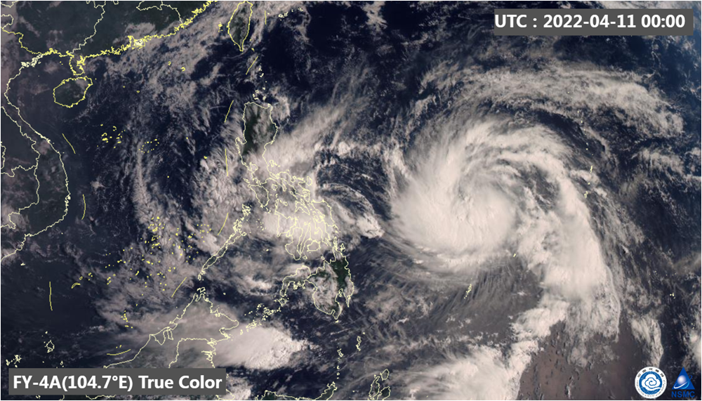
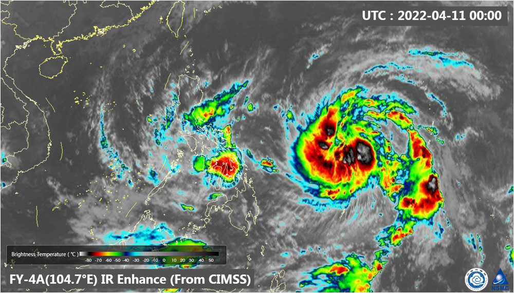
The true color image of FY-4A (Fig. 1) meteorological satellite shown the circulation structure of typhoon “MALAKAS” is still developing, and “MEGI” has an asymmetric structure. The Infrared enhanced cloud image (Fig. 2) of FY-4A meteorological satellite at 00:00 shown the cloud top brightness temperature of the circulation center of typhoon “MALAKAS” and “MEGI” are below -70℃.
The typhoon “MALAKAS” is expected to move northwest and then move northeast at a speed of about 15-20 kilometers per hour, with the strength increases gradually. The typhoon “MEGI” is expected to stay in position and move eastward on the April 11, with the strength gradually weaken.(Source: NSMC)

Fig. 1. The true color image of “MALAKAS” and “MEGI” , 00:00(UTC) on April 11, 2022.

Fig. 2. Infrared enhanced cloud image of FY-4A, acquired at 00:00 (UTC) on April 11, 2022

