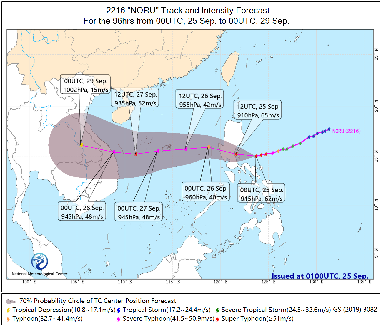
The No.16 typhoon "Noru" (super typhoon level) is located at at 17:00 on September 25 (BJT, UTC+8) in the offshore waters of the eastern part of Luzon Island, Philippines. The maximum wind force near the center is 16 (55 m/s), the lowest pressure in the center is 930 hPa. It is expected that "Noru" will move to the north-west direction at a speed of about 25 km/h, and will make landfall on the eastern coast of Luzon Island of Philippines this evening (48-55 m/s, 15-16, strong typhoon or super typhoon). It will enter the central and eastern waters of the South China Sea on the morning of 26th, then move westward and gradually approached the eastern coast of Vietnam.

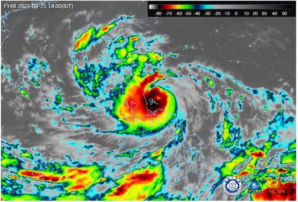
The monitoring of FY4B satellite infrared enhanced map at 14:00 (BJT, UTC+8) showed that the convective cloud system near the "Noru" center and its southwest was developing vigorously, and the area where the cloud top bright temperature was lower than - 70 ℃ was expanding.

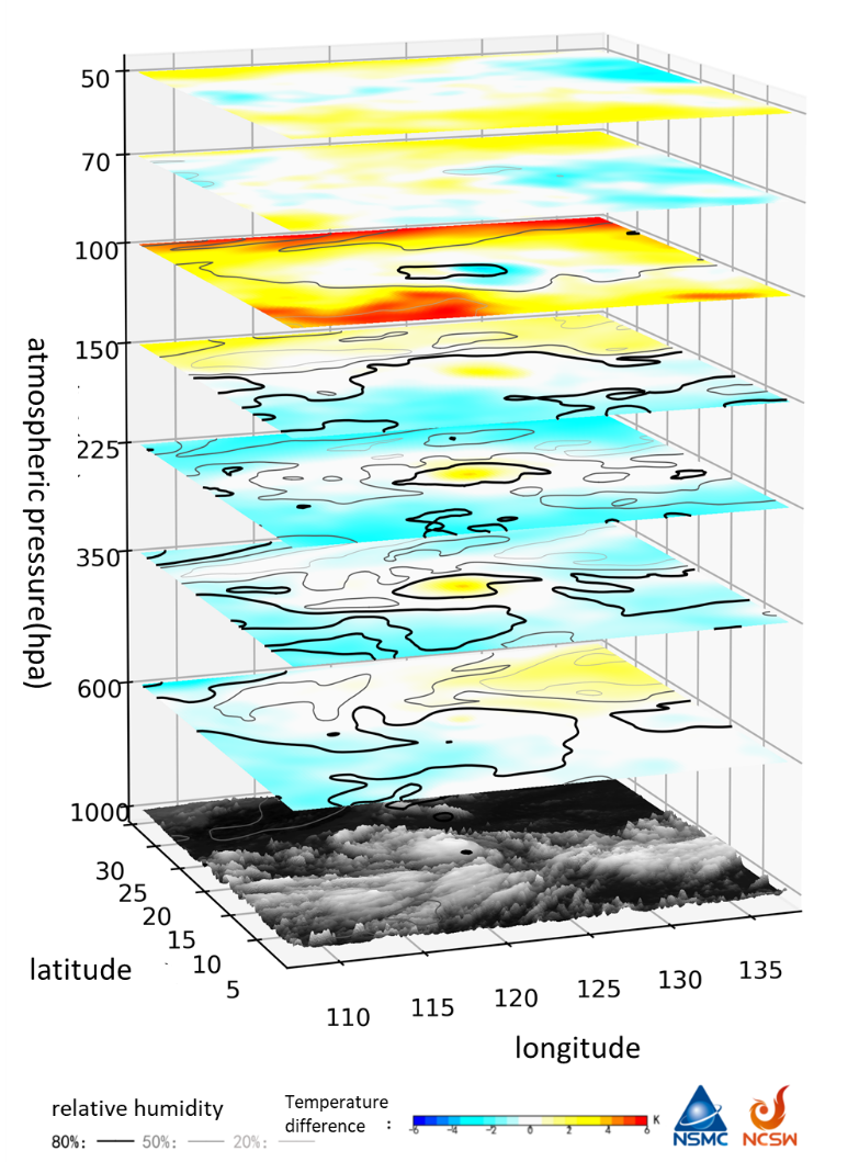
Based on the temperature and humidity profile of CMA-GFS forecast data, combined with the temperature and humidity profile data of FY-3D VASS, the regional 3D warm core structure of typhoon " Noru" is analyzed. It can be seen that there is a clear warm layer structure in the upper layer.

Under the joint influence of cold air and "Noru", it is expected that from 20: 00 on 25th to 20: 00 on 26th (BJT, UTC+8), there will be 6-7 grade winds and 8-9 grade gusts over most of the South China sea, with 8-12 grade winds and 13-11 grade gusts in the central and eastern South China Sea and the waters near zhongsha islands. On 25th to 26th , there will be heavy rain in the central and northern Philippines with torrential rainfall in the local areas. On 27th to 28th , there will be heavy rain in the south-central part of Vietnam with torrential heavy rainfall in the local areas. (Source: NMC, NSMC)

