

Typhoon "BUALOI" is expected to bring strong winds and heavy rain to the South China Sea and the Indochina Peninsula
Typhoon "BUALOI" (formerly a severe tropical storm) has intensified into a typhoon as of 0000 UTC on the 27th. Currently, its center is located approximately 440 kilometers southeast of Hainan Province in China. It is expected that "BUALOI" will move rapidly northwestward at a speed of around 35 kilometers per hour, gradually gaining strength. The typhoon is forecast to make landfall along the central to northern coast of Vietnam during the evening to night of the 28th, after which it will gradually weaken (Figure 1).
Affected by Typhoon "BUALOI", from September 27 to October 1, regions including Vietnam, Laos, Myanmar, Thailand, and Cambodia will experience heavy to torrential rain, with some areas facing extreme downpours. The cumulative rainfall in most of these areas is expected to reach 50-90 mm, with some regions receiving 120-180 mm, and localized areas exceeding 300 mm (Figure 2). Attention should be given to the adverse impacts of the severe wind and rain on power facilities, transportation, and other industries, as well as the potential secondary disasters such as flooding, landslides, mudslides, and urban waterlogging that may be triggered by the intense rainfall.
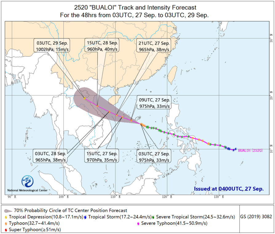
Figure 1: 48-hour Track Probability Forecast for Typhoon "BUALOI" (No. 20) This Year
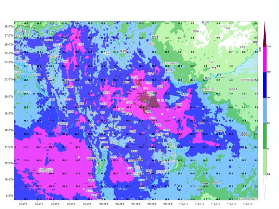
Figure 2: Forecasted Accumulated Precipitation from 1200 UTC on September 27 to 0000 UTC on October 2 (Unit: mm)
![]()
Author: Zhao Wei, Zhang Ling Reviewer: Bao Yuanyuan
English reviewer:Wang Yi Issue approver:Dai Kan