
Strong cold air activity is observed in Central and Eastern Europe and Southeastern Canada
It is forecasted that from the 16th to the 18th, influenced by the eastward movement of an upper-level trough (Figure 1), a significant cold air mass will affect Central and Eastern Europe. Regions including western Austria, eastern Belarus, Moldova, eastern Romania, central and northern Bulgaria, Serbia, Ukraine, and central and western Turkey will experience temperature drops of 6-8°C, with localized decreases exceeding 10°C (Figure 2). This will be accompanied by strong winds of 6-7 levels, with localized gusts exceeding 8 levels. The aforementioned areas will also see light to moderate rain, with localized heavy downpours.
From the 17th to the 19th, influenced by the eastward movement of an upper-level cold vortex (Figure 1), a strong cold air mass will impact southeastern Canada. Saskatchewan, Manitoba, Ontario, and Quebec will experience temperature drops ranging from 8 to 12°C, with localized areas seeing more than 14°C (Figure 3). This will be accompanied by strong winds of 6 to 7 levels, with localized gusts exceeding 8 levels. Southeastern Saskatchewan and Manitoba will face moderate to heavy rain, with isolated areas experiencing torrential downpours and intense convective weather such as short-term heavy rainfall. Attention should be given to the adverse effects of the temperature drop and strong winds on power infrastructure, transportation, and other industries in the aforementioned regions.
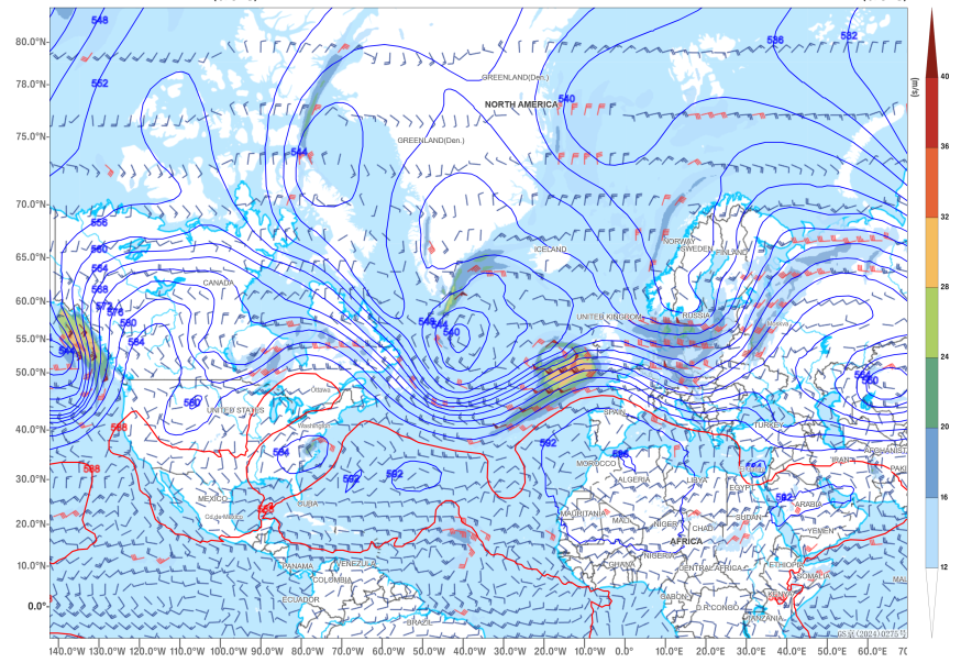
Figure 1: Forecast of 500 hPa Geopotential Height and 850 hPa Wind Field at 08:00 on September 17
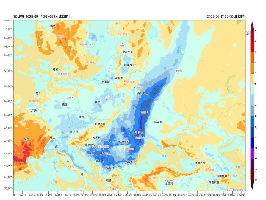
Figure 2: 24-Hour Temperature Change Forecast at 2m Above Ground Level for Europe on September 17
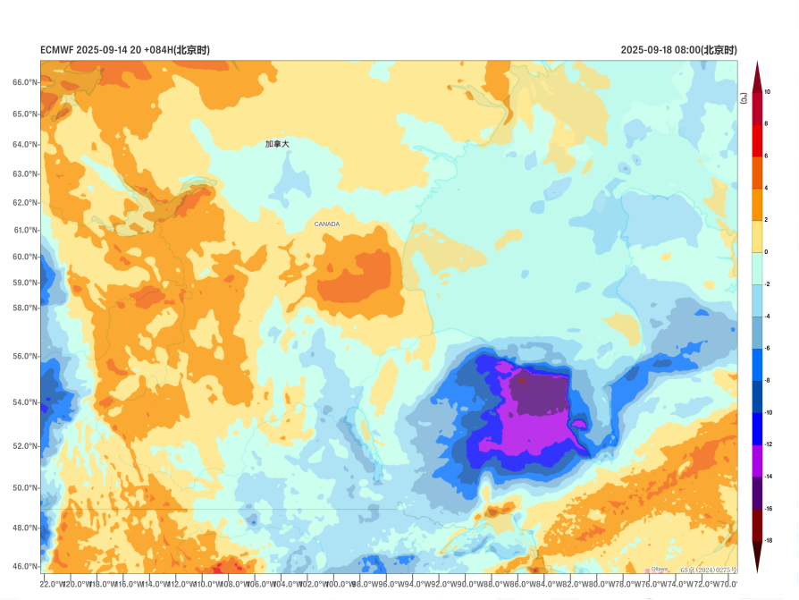
Figure 3: 24-Hour Temperature Change Forecast at 2m Above Ground Level for Canada on September 17
![]()
Author: Zhao Wei Reviewer: Cai Xiangning
English reviewer:Wang Yi Issue approver:Dai Kan