North America Will Experience Strong Winds, Cooling, and Precipitation
From October 11 to 14, influenced by the eastward movement of a deep upper-level trough, parts of southern Canada and northern United States will experience a temperature drop of 8 to 12°C, with localized drops exceeding 14°C (Figure 1). This will be accompanied by strong winds of 5-6 on the Beaufort scale, with gusts reaching 7-8 and locally reaching 9-10 (Figure 2). Additionally, regions including Alaska, northern Canada, Manitoba, Alberta, and the northwestern United States will occur medium to heavy snowfall, with localized blizzard or severe blizzard conditions. The cumulative snowfall during this period is expected to range from 5 to 20 mm, with some areas exceeding 30 mm. Central-eastern Canada and the central-western United States will occur medium to heavy rainfall, with localized heavy rainstorms (Figure 3). Precautions should be taken against the adverse impacts of strong winds, cooling, and precipitation on local power transmission and transportation systems.
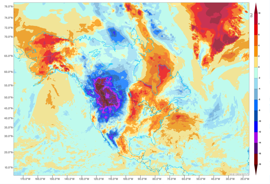
Figure 1 Forecast of 48-hour Temperature Change at 2 meters above ground level(Unit: °C) at 00:00 UTC on October 13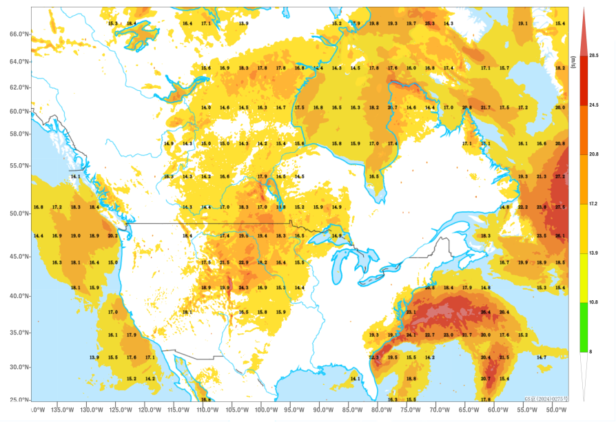
Figure 2 Forecast of 24-hour Maximum Gust(Unit: m/s) at 00:00 UTC on October 13 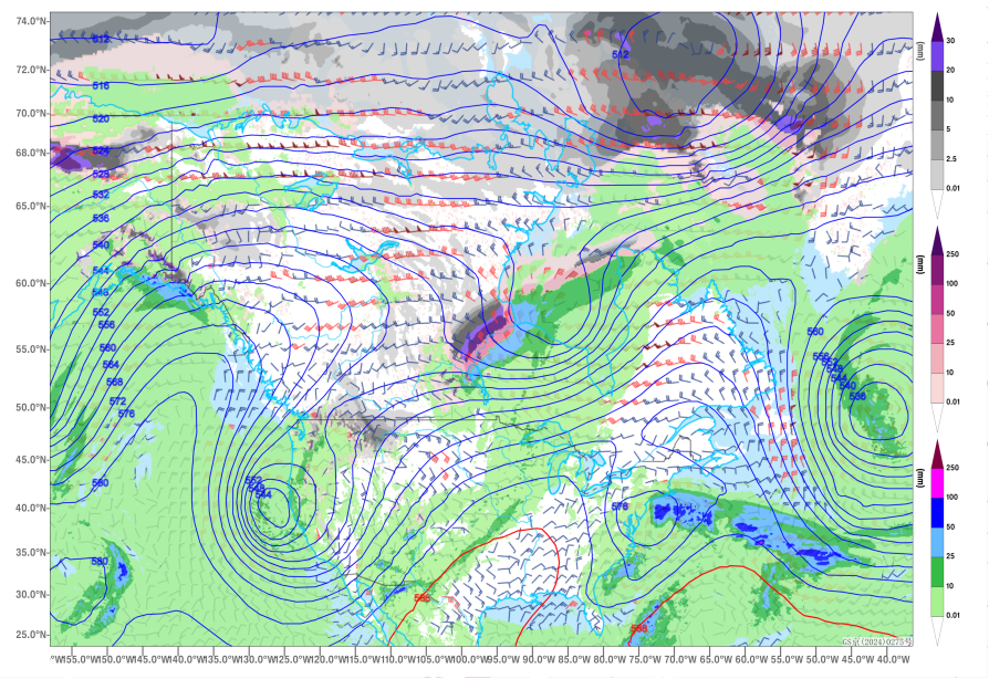
Figure 3 Forecast of 24-hour rainfall and snowfall (units: mm), 500 hPa geopotential height(contours), and 850 hPa wind field(barbs) at 00:00 UTC on October 14
![]()
Author: Hu Yi Reviewer: Niu Ruoyun
English reviewer:Wang Yi Issue approver:Dai Kan