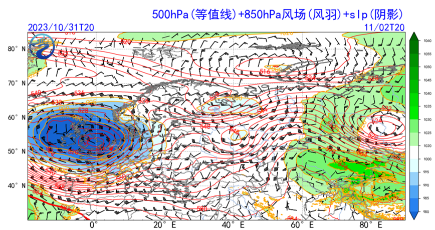
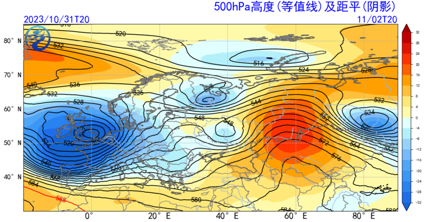
At the beginning of November, 2023, the extratropical cyclone "Ciaran" formed and moved eastward, beginning to affect most parts of Western Europe on the 1st Nov. (Figure 1a). The central pressure of the "Ciaran" will reach 955 hPa with its center locating between south of England and northwest of France (Figure 1b), which will bring severe weather such as gale, rainstorm and blizzard to many European countries.
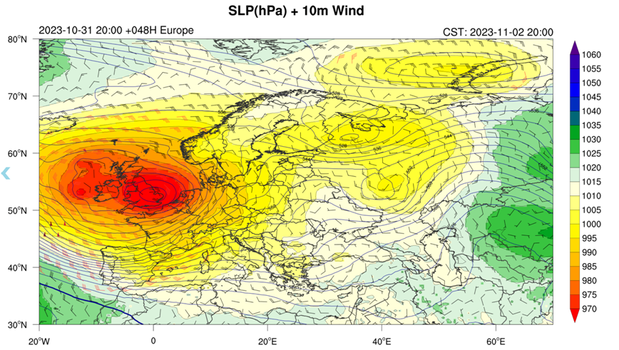
It is estimated that due to the influence of the "Ciaran", the pressure gradient in the coastal areas of western Europe, central Europe and southern Europe will increase sharply. In some areas of Britain, France, Germany, the Netherlands and other countries, the wind force will reach 6-7 grade, and the gust will reach 8-10 grade, and the gust in some coastal areas such as the English Channel will exceed 12 grade (Figure 2). Since 1st Nov, there will be light to moderate rain in western Europe, central southern Europe and central eastern Europe, and some areas will be heavy to torrential rain.
It is estimated that the influence of the "Ciaran" will weaken on the night of 3rd Nov, and another cold air mass originating from the Arctic will move over the North Atlantic on 4th Nov, may lead to a new storm in Western Europe. The storm will still centered on Britain, and central pressure is close to 965 hPa, and there will be strong wind and rain again in western Europe, southern Europe and central Europe.


Figure 1
Figure1. Anomaly field of Geopotential height at 500 hPa at 20: 00 on 2rd Nov, 2023 (Beijing time) (a); 850hPa wind field and sea level pressure field (b)

Figure 2. Sea level pressure and 10m wind field forecast of EC model (20: 00 Beijing time on 2rd Nov, 2023).

