
"NOKAEN" will bring severe wind and rain to the Philippine Islands
At 00:00 am today (16th) (UTC, the same below), the center of Typhoon No. 1 of this year, "NOKAEN" (tropical storm level), was located approximately 930 kilometers southeast of Manila, Philippines (11.1°N, 128.8°E). The maximum wind force near the center was 8 levels (18 m/s), the lowest central pressure was 998 hPa, and the radius of the seven level wind circle was 150-300 kilometers. It is expected that 'NOKAEN' will move towards the northwest at a speed of 15-20 km/h, gradually increasing in intensity. The maximum intensity can reach tropical storm level or severe tropical storm level (23-28 m/s, 9-10 levels) (Figure 1).
Affected by this system, over the next three days, there will be moderate to heavy rain in the Philippines. Among them, there will be rainstorm to heavy rainstorm in the east of Luzon Island, the east of Visayas Islands and the north of Mindanao Island, with localized extreme rainfall. The cumulative precipitation is forecasted to be between 50 and 90 mm, with the Bicol Region and other areas receiving 100 to 180 mm, and some localized areas exceeding 250 mm (Figure 2). The above-mentioned areas have wind speeds of 4-6 levels, while coastal areas have wind speeds of 7 levels and gusts of 8-9 levels (Figure 3). Attention should be given to the potential secondary disasters caused by the intense rainfall, such as flash floods and urban flooding, as well as the adverse impacts on transportation and other industries.
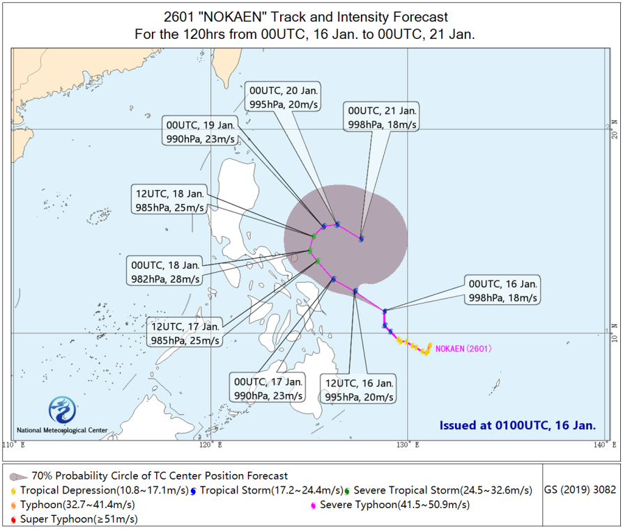
Figure 1 120-hour Probability Forecast for the Track of Typhoon "NOKAEN" (From 00:00 on January 16 to 00:00 on January 21, UTC)
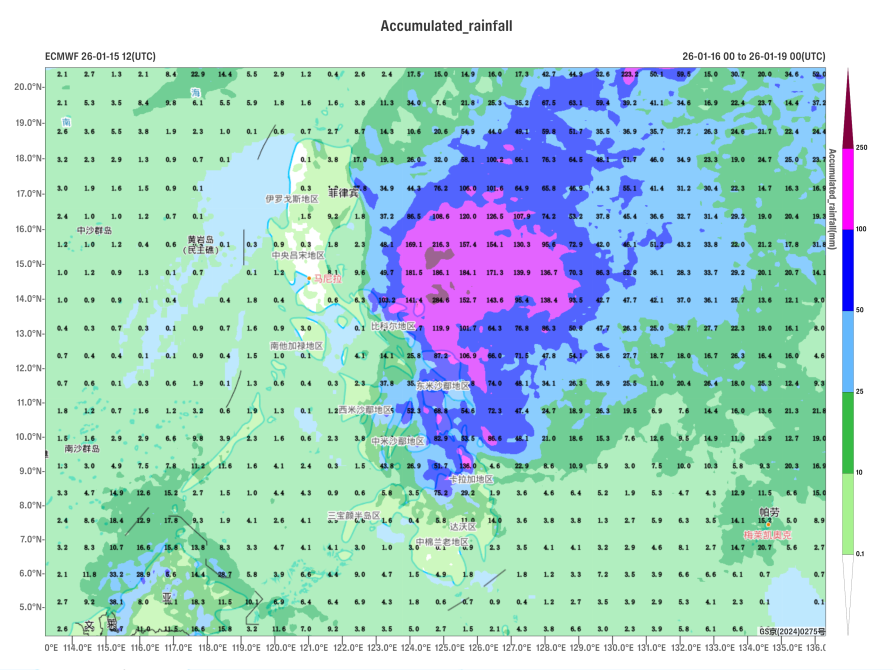
Figure 2 Forecasted Accumulated Precipitation from 00:00 on January 16 to 00:00 on January 19 (UTC) (Unit: mm)

Figure 3 Forecast of Maximum Gusts from 12:00 on January 18 to 12:00 on January 19 (UTC) (Unit: m/s)
https://www.wmc-bj.net
![]()
Author: Xu Xianhuang, Qu Hongyu Reviewer: Min Yin
English reviewer:Wang Yi Issue approver:Dai Kan