



Heavy Rainfall in Nepal and the Indochina Peninsula
Over the next three days, influenced by the Bay of Bengal depression and an upper-level trough (Figure 1), heavy to torrential rain is expected in northern India and Nepal. In particular, parts of central Nepal and northern India will experience intense, localized downpours. Across most of these areas, accumulated rainfall will range from 60 to 100 mm, with localized amounts exceeding 150 mm (Figure 2). Meanwhile, moderate to heavy snow is forecast for high-altitude areas of Nepal and Bhutan, with localized blizzards or severe blizzards. Additionally, under the influence of another tropical depression (Figure 1), heavy to torrential rain will affect central and southern Myanmar, central and western Thailand, western Cambodia, and southern Laos. Specifically, parts of southern Myanmar and western Thailand will experience intense downpours or extraordinarily heavy rain. Accumulated rainfall in these regions will range from 80 to 150 mm, with some areas receiving 180 to 230 mm, and localized totals surpassing 400 mm (Figure 2). Precautions are advised against potential secondary disasters triggered by the heavy precipitation, including flash floods, landslides, and debris flows.
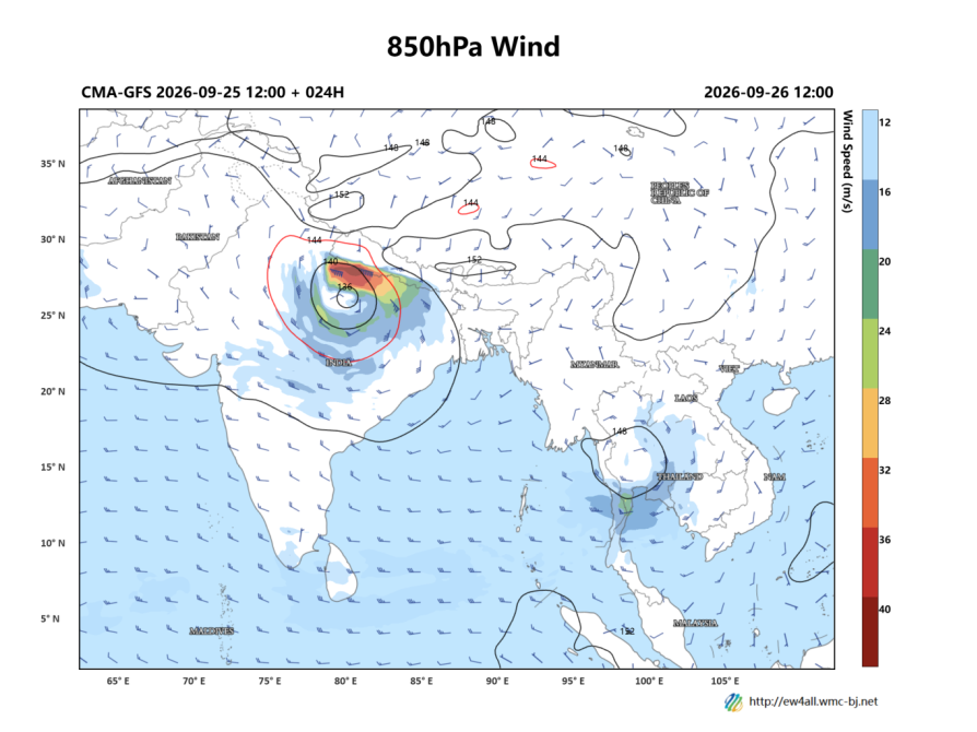
Figure 1: Forecast of 850 hPa geopotential height (contours, units: dagpm) and 850 hPa wind field (barbs, units: m/s) at 12:00 UTC on September 26, 2026
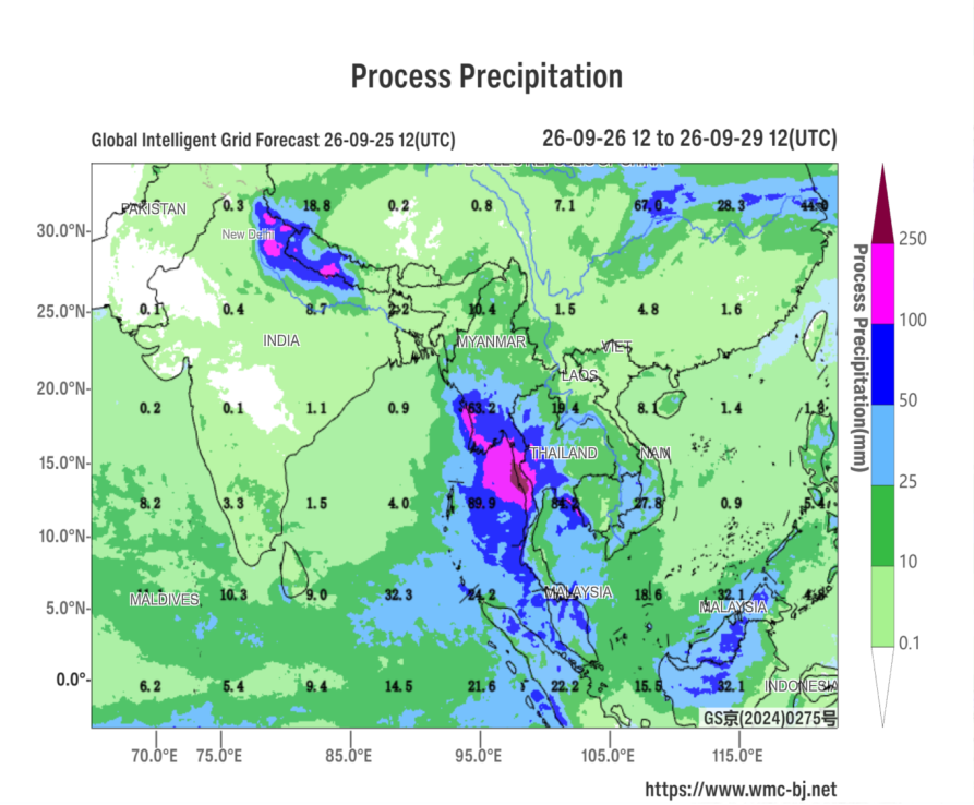
Figure 2: Forecast of Accumulated Precipitation from 12:00 UTC on September 26, 2026 to 12:00 UTC on the 29th (Unit: mm)
https://www.wmc-bj.net

Author: You Yuan Reviewer: Ma Jie
English reviewer:Wang Yi Issue approver:Dai Kan